Buying land sounds simple until you realize that not all acreage is equally usable. In Wayne County, a parcel’s value can change quickly based on wetlands, flood hazards, road access, zoning, and whether you can actually support a well and septic system. If you are thinking about buying land here, this guide will help you focus on the details that matter most before you write an offer. Let’s dive in.
Why Wayne County Land Varies So Much
Wayne County sits along the southern shore of Lake Ontario between Rochester and Syracuse, and its landscape changes more than many buyers expect. You can find lakefront areas, Erie Canal corridor locations, low-lying marshland, and gently rolling farmland across the county. That variety can be appealing, but it also means two parcels with similar acreage can have very different building potential.
The county’s agricultural base also plays a major role in land value. According to the Wayne County farmland protection plan, 168,556 acres are in agricultural land cover, which is 44% of the county, and 60.7% of that agricultural land is USDA prime farmland. In practical terms, some parcels may hold value not just as a homesite, but also for agricultural use.
Start With Usable Acreage
When you look at land listings, the total acreage is only the starting point. What matters more is how much of that land is actually usable after you account for setbacks, wetlands, flood-prone areas, drainage, septic reserve area, and access. In Wayne County, raw acreage and buildable acreage are often not the same thing.
That is why official mapping tools matter. The Wayne County Open Data Portal includes parcel, land use, elevation, environmental, hydrography, natural hazards, infrastructure, transportation, and assessment data. Before you fall in love with listing photos, it helps to compare the parcel against these GIS layers.
Verify Zoning by Town or Village
One of the biggest mistakes land buyers make is assuming zoning rules are the same across the county. In New York, zoning is primarily local, and the New York Department of State notes that cities and most villages and towns control zoning based on their own planning framework. That means the parcel’s town or village usually matters more than the county when you are checking allowed uses.
Wayne County GIS also updated and standardized zoning data in 2024 because many local datasets were older and paper-based. That is helpful, but you should still confirm the exact zoning district and permitted uses with the municipality tied to the parcel. If you want to build, split land, farm, or place a specific type of structure on the property, this step should happen early.
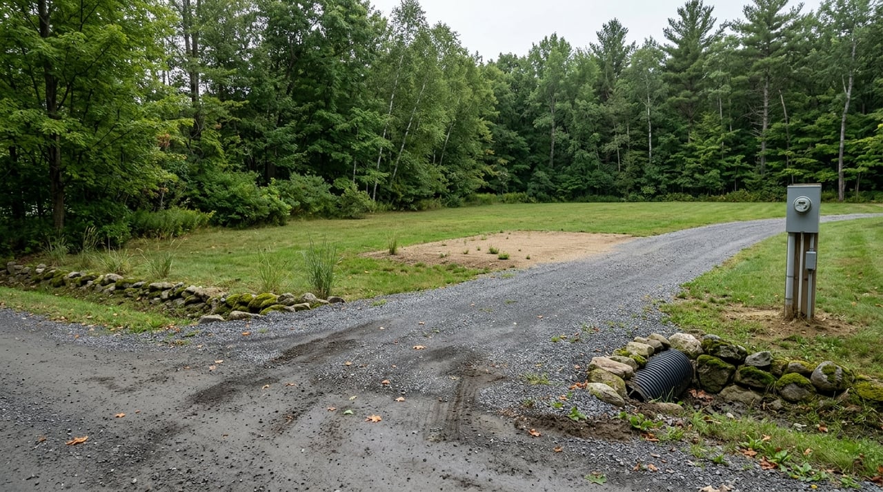
Check Road Frontage and Access
Acreage without practical access can create major headaches. If the parcel fronts a county road, Wayne County requires a highway work permit for driveway work, and the application process includes a site plan and county review of site conditions. Utility work in the county right-of-way may also require permits.
This is an important reminder for buyers. A parcel may look accessible on a map, but that does not automatically mean the driveway location will be approved or that utilities can be routed easily. Before you move forward, confirm legal road frontage and whether there is a realistic path for access improvements.
Understand Water and Sewer Options
Utility assumptions can get expensive fast. Wayne County states that the Wayne County Water & Sewer Authority supplies water in several towns, but most rural areas rely on private wells. If you are buying rural acreage, do not assume public water is available just because homes are nearby.
Sewer access can be even more important. If public sewer is not available, you may need an onsite septic system, and New York requires residential onsite wastewater systems to be designed and constructed under state standards, with plans prepared by or under the supervision of a design professional and reviewed by the agency with jurisdiction. In Wayne County, the planning checklist specifically calls for septic locations, a 50% expansion area, perc tests, and deep holes.
Soils Matter More Than Photos
Two parcels can look nearly identical online and perform very differently once soils are evaluated. Drainage, seasonal wetness, and soil suitability can affect whether you can install septic, where you can build, and how much site work may be needed. That is why a pretty field view should never be your only test.
For an early screening step, Wayne County Soil and Water points buyers to the USDA Web Soil Survey. It lets you search by address or area and generate soil maps and reports. If you are comparing multiple parcels, this can be one of the fastest ways to spot differences in drainage or septic potential before spending more on due diligence.
Watch for Flood and Wetland Constraints
Flooding is one of Wayne County’s most common hazards, and the county advises buyers to be careful in low-lying areas, near bodies of water, and downstream from dams. The county also recommends knowing whether a home or business is in a floodplain and considering flood insurance even outside the 100-year floodplain. For land buyers, flood risk can affect where you build, what it costs to improve the site, and how much of the land stays usable year-round.
Wetlands deserve the same level of attention. Wayne County GIS provides DEC wetland layers and buffer data, but the county’s DEC wetland mapping resource notes that boundaries are approximate and may need field verification when a project could affect a wetland or regulated buffer. In simple terms, parcel lines and usable land lines are not always the same.
Know If Agricultural District Rules Apply
Wayne County has a large Agricultural District No. 1, covering about 11,425 parcels and 293,000 acres, according to the county’s Agricultural District page. This matters because farmland within the district may be assessed based on agricultural production value rather than development value. New York Agriculture and Markets also notes that agricultural districts are intended to protect and promote farmland and farm operations.
If you are buying acreage in or near active agricultural areas, ask how district status may affect the parcel. This does not automatically make a property better or worse, but it can shape valuation, use expectations, and the long-term feel of the surrounding area. For buyers who want a homesite with room to grow, this is an important layer of context.
Review Site Plan Requirements Early
Wayne County’s planning referral checklist offers a useful snapshot of what often affects parcel feasibility. The county highlights items such as water line availability, agricultural district status, wetlands, flood hazards, nearby water bodies, setbacks, wells, septic locations, perc tests, deep holes, and septic expansion area. If 1 acre or more of soil is disturbed, the checklist also says a pollution prevention plan is required.
This is why early due diligence matters so much with land. A parcel may be large enough on paper, but once you factor in setbacks, septic reserve, drainage, and stormwater requirements, the buildable area can shrink quickly. Reviewing these issues before writing an offer can save time, money, and frustration.
Consider Prior Use and Environmental Risk
Not every land parcel has a clean history. If the property may have had a prior commercial, industrial, or other nonresidential use, it is smart to look more closely at environmental risk. Wayne County offers a Brownfield Assessment Program for properties with known or suspected contamination.
This is especially relevant for sites with older improvements, unusual fill, or a past use that does not match today’s appearance. You do not need to assume a problem exists, but you do want to ask the right questions before closing. With acreage, what happened on the land years ago can still affect today’s plans.
Questions to Ask Before You Offer
Before you move ahead on land in Wayne County, try to get clear answers to these questions:
- Which town or village controls zoning for this parcel, and what uses are allowed today?
- Does the parcel have legal road frontage and a workable access path?
- If it fronts a county road, what permits may be needed for the driveway?
- Is public water available, or will you need a private well?
- Is public sewer available, or will the site need septic design and soil evaluation?
- Do wetlands, flood zones, drainage swales, or nearby water features reduce usable acreage?
- Is the parcel located in Agricultural District No. 1?
- After setbacks, septic reserve, and site requirements, how much land is actually buildable?
- Is there any sign of prior use that could justify environmental review?
A Smarter Way to Buy Wayne County Land
Buying land is different from buying a finished home because you are not just evaluating what exists today. You are also evaluating what the property can realistically become. In Wayne County, that means looking past the acreage number and focusing on zoning, access, soils, utilities, environmental constraints, and agricultural context.
If you want experienced guidance as you compare parcels in the Finger Lakes region, Vicki Schamel can help you evaluate the practical details that shape land value and buildability, so you can move forward with more clarity and confidence.
FAQs
What should you check before buying land in Wayne County, NY?
- You should confirm local zoning, legal access, water and sewer options, soil suitability, wetlands, flood hazards, and how much of the parcel is actually usable after setbacks and site requirements.
Why is usable acreage more important than total acreage in Wayne County?
- Usable acreage matters more because wetlands, flood-prone areas, septic reserve requirements, drainage issues, and setbacks can reduce how much land you can actually build on or use.
How do you research a parcel in Wayne County, NY?
- A strong starting point is the Wayne County Open Data Portal, which includes parcel, elevation, environmental, natural hazard, infrastructure, transportation, and assessment data.
Do all land parcels in Wayne County have public water and sewer?
- No. Wayne County says water service is available in several towns through the Wayne County Water & Sewer Authority, but most rural areas are served by private wells, and sewer availability varies by location.
How do wetlands affect land purchases in Wayne County?
- Wetlands and regulated buffer areas can reduce buildable area, change site design options, and require additional review, so mapped wetlands should be taken seriously and may need field verification.
What is Agricultural District No. 1 in Wayne County?
- It is a large county agricultural district that includes many parcels and acres of farmland, and its status can affect agricultural protections and how eligible farmland is assessed.
Do you need a permit for a driveway on a county road in Wayne County?
- Yes. Wayne County says driveway work on county roads requires a highway work permit, along with a site plan and county review of site conditions.
How can you compare soil conditions on Wayne County land parcels?
- You can use the USDA Web Soil Survey, which Wayne County Soil and Water recommends for generating soil maps and reports to compare drainage and suitability across parcels.